|
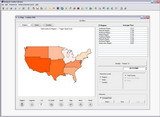
Using this module, a company that sells products country or regionwide could compare sales vs. population for each district, state, county, etc. on a map. Visually analyze measured behaviors using exceptions and alarms. Using it, we can geographically display, in a very simple and intuitive way, your key indicators compared against, by example, a county population.
The corresponding cartography can be acquired directly to Hallmore Group or through our technology partner Geoscape International, Inc.. Also, G-Olap allows, automatically, to use custom maps according the client need.
|
|
 |

